New Labour Government, accelerated push for Net Zero
by Dr Samantha Harrison-Curran, GIS Team Lead
In the wake of last week’s seismic political shift, buoyed by caffeine and cautious optimism, all my GIS brain could think about was how much I love maps. Front and centre of every news outlet was the new technicolour constituency map, highlighting the new Labour government’s majority in gloriously visual terms; and the quadrupling of green highlighting the Green party’s record gain in seats.
With promises of a ‘Green Industrial Revolution’ from the new government, a question started to spark my curiosity: how can we map and interrogate this political shift in a meaningful way for the renewable energy sector?

The Promise of New Onshore Wind in England
Then came Rachel Reeve’s inaugural speech as the UK’s first ever female Chancellor:
“And, as of today, we are ending the absurd ban on new onshore wind in England. We will also go further and consult on bringing onshore wind back into the Nationally Significant Infrastructure Projects regime, meaning decisions on large developments will be taken nationally not locally. Second, we will give priority to energy projects in the system to ensure they make swift progress…”
Geospatial Mapping of Previously Refused UK Refused Planning That May Shift to Positive Planning Outcomes
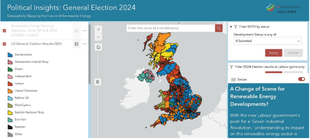
A lightbulb came on: we already had the Renewable Energy Planning Database (REPD), a dataset freely available from the Department for Energy Security and Net Zero (DESNZ) in our data holdings. Combining this with the electoral results could offer insight into previously refused planning applications for renewable projects and highlight both regions and opportunities worthy of a revisit.
And with that, the first iteration of ITPEnergised, Part of SLR, Political Insights web app was born, and you can interact with a redacted version of this tool here.
The next question? How far back can we go…. The REPD holds planning applications from as far back as May 2001, spanning a total of 6 general elections prior to this year. And oh look, the Electoral Calculus (https://www.electoralcalculus.co.uk/) has all the electoral results available for download in csv format. The pre-processing required to present this in geospatial format would be worth it if we might be able to see the effects of political change on the outcome of applications over time and help predict future behaviour.
Sometimes the quality, cost and availability of geospatial data can be incredibly frustrating but sometimes you can put together an insightful resource from publicly available data. This is how it should be. Like the data that underpins it, the Political Insights redacted web app is freely available to help drive forward the Net Zero agenda. For more information on the full underlying datasets, and specifically their use in identifying those refused projects which may have a more positive chance of positive planning permission now, please contact Sam at samantha.harrison-curran@itpenergised.com.
We look forward to acceleration of Net Zero with the new Labour government.
